Emissions of CO2 from burning fossil fuel contributes significantly to a gradual increase in the world’s average temperature. What’s also known but less understood is the erratic variation in the average temperature due to cycles in the ocean, resulting in episodes of El Nino and La Nina. Some claim that these temperature extremes are well-understood as a result of changes in the trade winds, as the wind pushes the water around the Pacific ocean, exposing colder or warmer water to the surface. This may have been a perfectly acceptable explanation, except it doesn’t address what causes the wind to vary — in other words the source of the erratic wind variation is just as unknown.
So we are still left with no root cause for the ocean cycles. Apart from the strictly seasonal changes we have no explanation for the longer-term pattern of natural variation observed.
The likely key to a physical understanding rests in solving the fluid dynamics of the ocean. There are two aspects to this that have long presented an intellectual challenge. The first challenge has been to model the sloshing dynamics of a huge body of water — this typically involves numerical calculation in the form of computational fluid dynamics (CFD). The second challenge is to feed in a possible forcing and see if that can match the cyclic patterns observed. This requires a search through plausible physical mechanisms. Complicating matters is that the cycles may be chaotic so that any agreement we find would be useless from a practical standpoint, as chaotic patterns are impossible to model regardless of the source forcing.
A clue to both challenges is to first look at tidal forcing via the moon and sun, the same causative agent for the well-understood ocean tides. This is not as wild a premise as one would first think. In fact, the entirety of CFD-based climate science rests on the foundational mathematics of Laplace’s Tidal Equations, which were first formulated by the French mathematician Pierre-Simon Laplace in 1776. Over the years these were renamed the shallow-water wave equations (possibly since no one could find a tidal connection to climate), and presented as a simplification of the more complete Navier-Stokes primitive equations. 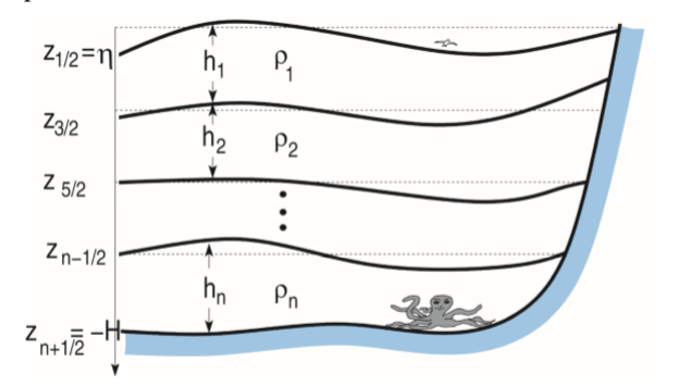 Alas, according to the current state-of-the-art, only a few of the CFD climate models (aka GCMs) include any tidal input, and most of these are recent publications.
To cut to the chase, a solution to Laplace’s equations that clearly reveals the tidal connection to climate variability does in fact exist. As with many a complex differential equation, this solution is based on an ansatz, or an educated guess, that is only verified by the quality of the results. Given the size of the solution space for these equations, there are scores of potential guesses imaginable and these can be narrowed down by both (1) having to obey the equations and (2) matching the data. In this specific case, the way to evaluate the solution is to compare the model to a climate behavior such as the El Nino Southern Oscillation (ENSO).
We will skip the details of the solution and only point out the evaluation of the resulting model is conceptually no different than a conventional tidal analysis. All one needs to do is select the right combinations of monthly lunar tidal cycles (i.e. long-period tides) synchronized with the annual solar cycle and check to see if the model aligns with the results. The length of the ENSO time-series data is so long (>130 years) and the tolerances for tidal periods is so tight (down to the minute) that the result is binary in the sense that it will either work or it won’t.
One of the most robust methods of tidal analysis is the wavelet scalogram, which allows one to see the stability of each of the tidal constituent factors across the entire time series. A good example of its use in conventional tidal analysis is here, and how to apply it for ENSO/SOI is shown in Fig 1 below.

(click image to magnify)
The left-hand side is the ENSO data and the right is the LTE model with progressive levels of inversion to reveal the estimated tidal forcing shown at the bottom of the chart. These correspond to the known lunar and solar tidal forcing factors, which must be stable over the entire time-span of the data. The stability of the factors is demonstrated by how straight and regular the features are, in contrast to the apparent chaos in the top chart.
A more intuitive approach is to simply fit the model to the data (Fig 2 lower panel) and evaluate the spectral strength of the tidal constituents (upper panel). The labeling of the peaks (S*=sun, M*=moon) refers to the strongest known factors, which are also catalogued in terms of their significance in perturbing the rotational speed of the earth.


Besides ENSO, this approach will work on other climate indices (see Fig 3 below) given that a spatial scaling factor is calibrated for the geographical location of the index. Much like the same lunar and solar gravitational influence has a different tidal influence in various locations around the globe, the climate behavior will also have a differing response but a common forcing.

If this model checks out with further study it will become valuable for isolating the natural variation of climate from that due to anthropogenic global warming. We should point out that the model is fully described in our book Mathematical GeoEnergy and has been through the rigor of peer-review and several American Geophysical Union conference presentations.
And as something to further ponder, consider that if a human doesn’t first discover a pattern in nature, eventually a machine-learning algorithm will.
Added 9-2-2019
Compare the above analysis against the bizarre model of ENSO as provided by “Javier” on climate skeptic Judith Curry’s blog
82 responses to “Climate Variability vs AGW”
Hi Paul P,
This one is above my pay grade.
I know enough to understand that you may be onto something new, maybe even groundbreaking, but I’m pretty much in the dark, having forgotten al the math I ever knew beyond basic trig and algebra, besides suffering from old man color blindness. I can’t see the colors well enough to make sense of the graphics.
If you were a betting man, how much would you bet that ten years down the road, people will be frequently citing your work in this area ?
Given that you have already presented it to a major scientific organization, the odds must be at least fair or better.
OFM,
Paul thinks this is correct and reviewers have not noted any errors, but like much in science until you get influential scientists to confirm the analysis not much headway can be made. There is a tendency for many scientists to ignore major breakthroughs as they are too far out of the box so to speak. If it was a minor tweak to an existing model it would get more attention perhaps.
Note that the analysis also looks good to me, but someone with better mathematics and astrophysics or electrical engineering chops than me would be better able to evaluate this work.
Doug perhaps or his niece maybe.
The pattern has always been there but needs to be decoded before it’s identified.
The bet is whether an AI machine or a human will duplicate it first
OFM said:
Sorry for the colors, but adjusted so that you can click the image to blow it up real good.
Paul,
For the upper panel of figure 2 the horizontal axis is labelled “frequency (1/year)”. Can you explain in words what the frequency is at 10, 20, 30, … ? I would think it is one tenth of a year, 0ne twentieth of a year etc, low frequency on the left and higher frequencies on the right side of the chart.
Dennis, yes those are read as frequencies, so the lowest ones S* are once or twice per year and the next grouping M* are 12 per year which are the lunar monthly. That’s essentially how the tidal frequencies are associated with either the sun or moon cycles.
Ok got it. So perhaps Frequency (years) would have been clearer, at least to me.
Paul,
No, (1/year) is right, so 10 per year, 20 per year etc which is what I understood originally.
🙂 I let you correct yourself because that’s the way it will sink in.
Like OFM, I find this work extremely impressive, and far above my pay grade.
I am very interested in the topic of ocean ‘heat waves’, and long term ocean current trends, at a layman’s level.
Does this work shed light on, or change the thinking on, those areas?
Also, forgive me if this seems elementary, but what is meant by ‘forcing’ in the context of this topic? “The second challenge is to feed in a possible forcing”
Forcing is defined as anything that stimulates or forces a behavior. In this case it is the gravitational tug of the moon and of the sun that forces the ocean to slosh back and forth on these long time cycles, much like ocean tides but operating at a different level.
What does this gobbledygook have to do with peak oil?
Dan,
The Open Thread Non-Petroleum talks about many subjects such as the environmental damage and climate change. Read the Permian post or OPEC post which are both oil related.
Very interesting Paul.
If I’m reading the wavelet scalograms right,
there’s the Z (out of paper) axis of color meaning intensity,
the X (horizontal) axis is the progression of time,
and the Y (vertical) axis is the frequency expressed as period length in same units as X axis.
right?
Can you provide a key to the tidal constituents?
I can figure out some of them, but others I’m drawing a blank:
Sa = Solar annual
Ssa = Solar semi-annual (twice a year)
Sta = Solar ???
…
And maybe a note about the difference between and the values of the synodic and sidereal months.
ENSO got defined, but SOI = Southern Oscillation Index ???
I haven’t gotten or read your book yet, but plan to.
Have you done the next step, which is to subtract your ENSO model effect from a General Circulation Model and seen if/how much better the GCM model output fits the data in hindsight?
Correct on the first part
The key is:
Sa, SSa correct and Sta=1/3 year
Mf/Sidereal (13.66/27.32 day) and Msf/Synodic (14.77/29.53 day)
Some are also reproduced on this Wikipedia page
https://en.wikipedia.org/wiki/Theory_of_tides
https://en.wikipedia.org/wiki/Lunar_month
Thanks, one can always get it in a local library as well. Often an on-site access code from a university library is a possibility.

As to the next step, good idea, but I’m afraid one can’t just subtract it from an arbitrary GCM output. The way GCM’s work is that they assume the current state of the ocean and atmosphere and use that as initial conditions and then run the computation from that point forward. In other words, they may not use the true forcing at all because they are more concerned about just extrapolating from the current state.
In contrast, to use a tidal forcing as I am advocating, they will need to feed the equations from a time synchronized with the lunar and solar phase and then let the GCM grind away for several years as the cyclic gravitational pull operates on the ocean (what is called the “body force” in fluid dynamics).
They obviously have other aspects of forcing included in GCMs, such as the seasonal solar radiation signal that causes at least some of the most apparent climate variation. But the tidal input is still largely lacking.
For those having difficulty with the wavelet scalogram see link below.
https://reference.wolfram.com/language/ref/WaveletScalogram.html
On chart above horizontal is time (arbitrary units days, weeks, hours) the vertical axis is octaves.
Each octave is 2 times the frequency of the next lowest octave with zero being low frequency (like a low note in music) and the higher numbers representing higher frequencies (a high note in music). The colors represent the z axis (coming out of the screen) with yellow being a high positive magnitude and the red being a low or zero magnitude (signal strength). see three D representation below of figure above.
Thanks, those helped.
I did in fact use Wolfram Mathematica to generate those scalogram plots, so they can be reproduced accurately for anyone that has access to that tool.
For those not familiar with climate variability here is some info.
https://www.weather.gov/mrx/climatevariability
https://www.air-worldwide.com/Blog/Climate-Variability-vs–Climate-Change%E2%80%94What%E2%80%99s-the-Difference-/
http://www.wmo.int/pages/prog/wcp/ccl/faqs.php
Here climate modelers say it could get cool or hiatus more frequently if there is higher climate sensitivity.
They also say:
The paper also studied the chance that a decade in the 21st century could warm by as much as the entire 20th century — a scenario that the research team call “hyperwarming.”
Under a scenario where carbon dioxide emissions from fossil fuels continue to increase, the chance of hyperwarming is even more dependent on climate sensitivity than the long-term global warming trend.
Increasing the climate sensitivity by 50% from a central estimate of 3 ºC would increase the mean global warming to the end of this century by slightly less than 50%, but would increase the chance of a hyperwarming decade by more than a factor of ten.
https://www.sciencedaily.com/releases/2019/07/190722111921.htm
Uh, oh.
There’s nothing as satisfying as pulling numbers out of your cap and terrorizing people with it.
Most people are not easily terrorized by people brandishing scientific hypotheses — that’s reserved for shark sightings and real terrorists brandishing assault weapons in malls.
Plus, Fernando apparently didn’t even click on the link, which doesn’t even sound scary on first read.
Yes, I have seen the idea discussed that climate variability will be enhanced by increases in GHGs, but until we can agree on the mechanisms of variability, it is not yet a truly strong hypothesis.
Terrorizing? Might want to think about using that term again. If you are afraid of some people playing with models then maybe you should hide under your bed. One degree in ten years is nothing compared to the 5C and 10C rises found using ice core data over similar periods.
That’s the real world baby. Shiver in fear now.
Maybe snowflake needs a safe space, away from the harsh realities of the world?
Is climate sensitivity linear or how does it work? If a doubling of CO2 gives 3C degrees higher temperature, how much higher will the temperature increase with a second doubling?
Tom,
If it is a linear relationship then 4 times pre-industrial CO2 levels (about 280 ppm atmospheric CO2 concentration) would result in 6 C of warming above the Holocene average up to 1750 (my definition of pre-industrial, which generally is not very well defined in the literature), if we assume an equilibrium climate sensitivity of 3 C for a doubling of atmospheric CO2. Note that a quadrupling of atmospheric CO2 is not very likely as their is probably not enough fossil fuels to make that happen, though some claim that perhaps methane hydrates in the deep ocean might cause a massive spike in CO2 that is a bit of a fringe contingent. Mainstream climate scientists mostly dismiss that though they seem to think there is much more coal available than many mainstream energy analysts posit. A doubling of atmospheric CO2 is likely, a quadrupling, not so much (maybe a 1% probability at most).
I suspect ocean currents are affected by Rome 2012 study pollution as much as the air is. One area of change is Japan’s 70 year dump garbage at sea resulting in a mini continent mid North Pacific. Evaporation I’m reduced, in time microscopic plastics breakdown enter the hydro cycle and human female intact in western USA
Is it possible that thel Atlantic Multidecadal Oscillation can explain parts of the Arctic sea ice melting?
Or possibly the North Atlantic Oscillation (NAO) or Arctic Oscillation (AO), which may be involved in bending the jet stream. Look at this recent BBC video, where the meteorologist says “like a tide moving up and down” (hint, hint) and the tweet says hot spells “have all occurred almost exactly a month apart” – lunar month ? (hint, hint, hint)
If we can pin this stuff down years n advance like we can with ocean tides, we can master the climate, at least the natural variability part.
The heating of the Arctic from GHG and albedo changes is causing the jet stream to slow and undulate, forming patterns that did not exist before. Has the lunar orbit suddenly changed in the last few decades? It hasn’t, hint, hint.
” we can master the climate, at least the natural variability part.”
I hope you mean we can “understand” the climate rather than controlling the climate.
yeah, like getting a Master of Science degree.
Good luck with that.
Tell you how little climate scientists understand what should be beyond obvious. There’s a jet-stream reversal of stratospheric winds along the equator that reverses every 28 months called the QBO. Even after all these years they have not been able to make the extremely plausible correlation to the lunar nodal cycle.
The question is how they can make predictions on changes when they can’t even pin down the fundamentals?
Ocean cycles are probably caused by the same factor which shapes jet streams in the atmosphere: Earth/Sun electromagnetic fields.
ESA SWARM mission discovered that oceans generate their own magnetic field.
https://www.esa.int/Our_Activities/Observing_the_Earth/Swarm/Swarm_tracks_elusive_ocean_magnetism
OneofEU: “Earth/Sun electromagnetic fields”
???
I think that’s what we call sunlight, LOL.
Oceans generating their own magnetic field is a nothing, apart from an exercise in showing high instrumental sensitivity.
Ok, magnetic fields.
I put ‘electro’ to include non-sunlight wavelenghts and all kinds of secondary electric currents.
Nothing?
Even if small, it influences water molecules.
The very fact that it exists independently of the Earth core magnetic field is a testimony to its importance, as it could be a reason for thermal inertia of oceans, the inertia which probably is behind El Nino and La Nina.
Watch the simulation at the ESA site (the link above). The field clearly changes and wanders through different oceanic areas.
OneofEU,
If you have a model for this, then show it. The way science works is that everyone shares their own model fit to the empirical data, and then via the literature review process and/or technical application, the best approach is selected as the current understanding.
“Watch the simulation at the ESA site (the link above). The field clearly changes and wanders through different oceanic areas”
So whut … Do you have any idea how tiny that signal is and how sensitive state-of-the-art magnetometers are?
I don’t have a model, I have a hypothesis. Science starts with the latter, not the former.
It does not matter that the field is tiny, but that it can be distinguished as a factor affecting cohesive large areas.
To paraphrase yourself: Do you have any idea how tiny the water molecule is ?
Ok , so verify your hypothesis.
Both yours and mine ideas are just plausible hypotheses, resting upon the idea of suffcient reason (for me, electromagnetism, for you, tides), and so will stay until a definite reason will be found. Or not.
Yet you have no working model, only a premise.
My hunch is that you are faking it, just as a flat-earther would.
The map is not the territory, as the famous French writer Houellebecq said.
A model doesn’t matter if build upon faulty premises. The prime example: Ptolemy Earth-centered astronomy. His model worked. And still…. Another model was reflecting the reality.
There is not enough data to verify my hypothesis since ocean’s magnetic field has been discovered only recently.
[inserted by PP] This is false as this paper from 2014 on The Magnetic Tides of Honolulu demonstrates
https://www.researchgate.net/publication/262950729_The_magnetic_tides_of_Honolulu
There is plenty of detail in the data to go over, but since these researchers have been comprehensive, you won’t be left with much to resolve
We need several El Ninios together with magnetic field measurements around, and then we can say something more.
No, see above
added on 29.08.2019 19:00
Yes, I have seen. The paper is about geomagnetic tides, i.e. it concerns exclusively the Earth magnetic field. It also reflects data gathered on land, not on water. The Honolulu observatory is upon the volcano peak 4205 m above sea level.
https://en.wikipedia.org/wiki/Mauna_Kea_Observatories
I referred to the 2018 ESA discovery of oceans-own magnetic fields. I would like to see whether such a field somehow accompanies El Nino area.
Would it be appropriate if I said ‘Aloha’ now?!
The claim is that some of the geomagnetic measurement is picked up from the “ocean dynamo”.
You seem awfully confused in the difference between cause and effect. These geomagnetic disturbances are caused by the motion of electrically conductive saltwater (i.e. the ocean dynamo) leading to signals being picked up by magnetometers.
It is not the reverse of this, which is obviously what you are trying to convince everyone of.
A hammer doesn’t start beating you on the head spontaneously — you have to apply some effort — LOL
No, it is you who do not understand. ESA claim is that there are TWO independent magnetic fields on Earth, one generated by the planet’s core, another by oceans. The latter is not the derivative of the former, or so is the thesis.
I suppose such an oceanic magnetic field could be caused by movement of water as caused by Earth’s revolutions, not necessarily only by oceanic streams.
The water would still move inside the Sun magnetic field (the Earth field would be static from this point of view), which would induce water’s own.
On 29 August you wrote
‘signals being picked up by magnetometers.’ What exactly did magnetometers pick up?
Nietzsche wanted to philosophize with a hammer and it ended badly for him.
Science is no place for indignation, which you seem to covet.
added on 30.08.2019 16:13
Yes, so what? I did write ‘not necessarily ONLY by oceanic streams’: If a conductor moves inside a magnetic field, we got an electric current, don’t we? If the water on the surface of Earth is [relatively] still, it still moves together with Earth. AFAIK, El Ninio is relatively static when it lasts. It would pass together.
OneOfEU
You apparently know less than zero. The magnetic fields are being induced by electrically conductive SALT WATER moving back/forth & up/down in the ocean. The daily and yearly solar and tidal cycles are primarily what the magnetometers are picking up.
click to enlarge
I applaud this (incredible) attempt to understand the underlying forces that shape the climate.
I offer a hypothesis (guess) that does not intend to undercut this effort whatsoever-
The earths climate is the result of interplay of so many variable big factors, that our ability to tease out and predict the timing of patterns and magnitudes of the resultant status is bound to be ineffective.
In effect, I am saying that there is no pattern.
Maybe if there was no above/below sea level terrain, or no meandering jet stream, or no underwater volcanic activity, etc.
Of course, I could be very wrong.
When I brought up this idea previously, people seemed very threatened by the idea and jumped all over it. They seemed to suggest that of course we do/can understand these things.
The attitude surprised me.
Hickory,
That’s actually quite a common idea to suggest that the pattern is so complex that it will never repeat, which means there is no underlying pattern. This can happen for example with any number of chaotic formulations.
Yet, it is entirely possible to look at seemingly chaotic waveforms and extract patterns from it via techniques such as time-series cross-validation.
https://en.wikipedia.org/wiki/Cross-validation_(statistics)
The last presentation we did at the AGU demonstrated several cross-validation techniques applied to the model. Hoping that others pick up on these approaches to either verify the results or debunk the model
https://www.essoar.org/doi/abs/10.1002/essoar.10500568.1
The general idea of cross-validation is to show how statistically improbable it would be to generate a similar quality match using combinations of random signals.
Thanks Paul.
Clearly, my comments are coming from a place of naivety,
since I have no expertise in these areas.
To have a full picture, you should be also aware of double concepts of underetermination and overdetermination.
https://plato.stanford.edu/entries/scientific-underdetermination/
http://www.joelgehman.com/2014/02/management-and-the-problems-of-overdetermination-and-underdetermination/
‘This discussion prompted me to reflect a bit on the problems of overdetermination and underdetermination. “Overdetermination” refers to situations in which a particular effect could arise from any one of many possible causes (Hannan, 1971; Meyer & Goes, 1988). Or as Weick (1996: 308) put it: “Overdetermination is simply another way of stating Thompson’s first point that people have multiple, interdependent, socially coherent reasons for doing what they do.” Other organizational theorists have described such circumstances in terms of mean-ends ambiguity, or situations when there are multiple plausible alternatives (Hambrick, 2007). Overdetermination also can occur when mechanist notions of causality overwhelm alternative plausible explanations for what is happening (Boje, 2001).
“Underdetermination” refers to situations in which the “facts” are not clear or strong enough to establish a definitive explanation (Giddens, 1979; 1984: 17). This could be because facts themselves posses “interpretive flexibility” (Pinch and Bijker, 1987), meaning they are open to more than one plausible reading. Or, it could be that the available empirical evidence is limited or derived from narrow contexts (Shrivastava, 1986). In both cases, the available evidence is compatible with more than one theory or explanation. However, more facts may not resolve the problem; “science” can even make matters worse (Sarewitz, 2004). As Giddens (1979: 243) put it: “no amount of accumulated fact will in and of itself determine that one particular theory be accepted and another rejected, since by the modification of the theory, or by other means, the observations in question can be accommodated to it.”
OneOfEU, You just claimed you had a hypothesis, now what you’re slinging is serious doubts on you’re own hypothesis, whatever that is! LOL
That’s true, of course, but it does not make your hypothesis more probable in the same step.
OK then, how would you characterize the model described in this post — is it overdetermined or underdetermined? And is this in terms of mathematics or physics?
Obviously underdetermined in terms of physics due to your explanation being ‘derived from narrow contexts’ (see above).
I think that tidal forces have nothing to do with El Nino – these forces are periodical and symmetric.
You need something which appears only sometimes and is localized, a bit like a standing wave. That could be electromagnetic forces of Earth and Sun (they also have periodical elements but not so strong as tidal forces).
I have always been pretty good at physics, and have a good physical intuition, meaning a capability to identify where the problem lies.
Caveat: many physical phenomena are not really so friendly for mathematics. Magnetic forces are a good example.
Unfortunately, due to proliferation of computers and the quasi-Platonic faith in mathematics there is nowadays a tendency to seek solutions among those phenomena that can be relatively easily grasped mathematically, gravitational forces being a prime example here. Your current attempt only testifies to this problem.
added on 29.08.2019 16:36
I reiterate the affirmation of my intution – see, I have correctly identified the El Nino phenomenon as a standing wave, haven’t I?
Surely this wave is caused by something. Again, those causes may be irregular.
I really don’t think you know what you’re talking about, which will be ever more apparent if you keep on this path.
“You need something which appears only sometimes and is localized, a bit like a standing wave.”
The phenomenon of ENSO (El Nino Southern Oscillation) is defined precisely as a standing-wave dipole with fixed anti-nodes located near Tahiti and Darwin. Standing waves can arise in volumes of water just as they can with electromagnetic waves in a waveguide.
That’s why we solved the model as a standing wave, which is right in the text:

“I have always been pretty good at physics, and have a good physical intuition, meaning a capability to identify where the problem lies.”
Exactly when did your intuition leave you?
If you have 20 minutes to spend watching a video explaining the math of fluid dynamics, this is actually quite entertaining, even if you won’t understand it all.
At the 9 minute mark is a graphic describing initial conditions and forcing
https://youtu.be/ERBVFcutl3M?t=551
How much of the climate variability do you think is because of HARP? I seen a documentary all about it on The Science Channel a while back.
Most of natural climate variability is due to ENSO. The truly random part is due to sporadic volcanic eruptions, in which a decrease in global temperature is observed for a few years following a massive eruption such as Pinatubo or El Chicon.
There was some recent discussion about contrails
https://thebulletin.org/2019/07/airplane-contrails-are-changing-the-climate/
and the fact that 9/11 provided a few days of no-contrails data to analyze
https://globalnews.ca/news/2934513/empty-skies-after-911-set-the-stage-for-an-unlikely-climate-change-experiment/
None of this is observed in ENSO measurements since it is a differential measure and any of these extraneous factors are removed automatically from the data set.
Really? HAARP?
https://youtu.be/5WdLV3YRMvw
How much of the climate variability do you think is because of HARP? I seen a documentary all about it on The Science Channel a while back.
None of it is due to HAARP. And you did not see a documentary about HAARP causing climate change on the science channel. You are just lying. Well, that is unless they did a documentary on very stupid conspiracy theories.
I know I had heard of HAARP as being some conspiratorial project but kind of ignored all that as typical Art Bell stuff.
The bigger issue is that climate scientists can’t figure out QBO, see http://peakoilbarrel.com/climate-variability-vs-agw/#comment-686394
The connection between the lower ionosphere (mesosphere) oscillations and the stratospheric oscillations seems evident as I described here
https://geoenergymath.com/2019/06/16/ssao-and-msao/
This is actually more straightforward to interpret than ENSO
Paul, please stop talking in circles. Do you believe this Haarp conspiracy theory bullshit or not? A yes or no will suffice.
And you posted on contrails. Why? What has contrails to do with anything? Contrails are just ice crystals that dissipate quickly. Are you a “Chemtrails” conspiracy theorist as well?
Airlines use fossil fuels just as trucks and cars do. Their effect on climate change is in direct proportion to the fuel they burn, no more and no less. Their trailing ice crystals have nothing to do with it.
Hi Ron,
I believe you are mistaken in respect to the effects of contrails. Jets burn enormous quantities of fuel, and the contrails are big enough and numerous enough and last long enough to have a considerable effect, much more so than they would at ground level, because either fog or ice crystals , high up in the atmosphere, result in different amounts of solar energy reaching the ground and also being released back into space.
https://en.wikipedia.org/wiki/Contrail
It’s a long article with various sources cited in it.
Contrails seem to contribute to warming out of proportion to the quantities of fuel burned compared to ground transportation, liter per liter.
“Do you believe this Haarp”
No. Likely the guy brought the topic up because I worked at BAE for a long time, the prime contractor for HAARP.
Tidal forecasts are making an appearance along with the hurricane.
Miami floods at high tide anyways.
With the hurricane bearing down, here’s one take
https://theusposts.com/hurricane-tracker-what-causes-deadly-hurricanes-what-is-el-nino/
Important Notice
The EIA’s Petroleum Supply Monthly was due out today. I was to have a post tomorrow based on that report. But apparently it has been delayed. Therefore I cannot have the post until it posted.
Sorry about that.
Ron
On second thought, I will try to have a short abbreviate report tomorrow. But it will no state by state data other than something from Texas.
Ron
Paul, given that the hurricane storm surge will persist for more than 12 hours you will be able to claim both coincidence and causation ‘due to tides’. Rite?
Tides will be there whether or not a hurricane lands there.
Is anybody here willing to post an estimate on the annual probability of a mega drought, such as the DUST BOWL drought, occurring somewhere in a MAJOR bread basket any given year?
I’m totally unqualified to do so, but I’m guessing that the odds are probably not less than one in twenty, and probably not more than maybe one in eight or ten, just going by what I can remember from reading the news over the years.
But with the climate growing steadily hotter, the odds of such a drought happening are probably getting higher. The combined odds of a such a drought or excessive rain over such a large area are definitely getting higher.
Too much rain can be as bad or worse, because the effects linger on in the form of lost soil and infrastructure as well.
Some time ago I downloaded your ENSO prediction from your Context Earth site to see how it fared over time.
It is from this page:
https://contextearth.com/2016/11/21/presentation-at-agu-2016-on-december-12/
the figured named 5VVywf.png
I have tried to overlay that figure to the figure you present here (figure 2 bottom) since they don’t look the same despite both representing your model to 2020 and SOI data. They do not coincide, so it appears not only your model is changing over time, but also the way you represent SOI data. The 2016 figure has two prominent peaks at 1998 and 2016 corresponding to the strong Niños (low SOI values) and one strong valley at 1999 corresponding to the strong Niña. The present figure shows a more complex pattern with multiple peaks and valleys and now the strongest Niña appears in 2011.
I find that curious to say the least.
I was doing a transform on the data, and then comparing a forcing to the transform. That’s why what you are seeing didn’t match. I’ve since switched to alternative approaches.
BTW, I ‘m not confident yet in making predictions wrt ENSO. Those with a research background that’s applied typically spend more time characterizing processes until they become rock solid.
Amazon installs Colorado’s largest rooftop project
Spanning 19 acres, over 17,000 panels and boasting a capacity of 6 MW, the installation on Amazon’s newest fulfillment center is one of the largest in the world.
Outside of being the largest in the state, the 6 MW behemoth will be among the largest in the country and even the world. For reference, these 6 MW come courtesy of more than 17,000 solar panels across 19 acres, or more than 14 football fields in area.
The installation, Amazon’s first east of Nevada and West of Virginia brings the company to nearly 76 MW of solar installed on rooftops across the country. That’s good for strengthening the company’s place as having the 5th most installed on-site solar of any company in the country.
Outside of the United States, this project is Amazon’s first since reaching its 2017 goal of installing rooftop solar systems at 50 fulfillment centers by 2020. This is the company’s 51st rooftop installation and 32nd in the United States, with the rest of the portfolio made up of 12 installations in the European Union and seven in India.
more
https://pv-magazine-usa.com/2019/09/04/amazon-installs-colorados-largest-rooftop-project/
August 2019: 409.95 ppm
August 2018: 406.99 ppm
https://www.esrl.noaa.gov/gmd/ccgg/trends/index.html
2019 y-o-y growth rate is looking very three’ish.
https://www.esrl.noaa.gov/gmd/ccgg/trends/gr.html
Here is a graph from Arctic News showing the dramatic difference between the Anthropocene, the LGT and the PETM as far as temperature rise.
How many scientists were around in those other time periods to be able to precisely and accurately track temperature change?
Troll alert.
Don’t waste your time.
One more, for Perry:
Weekly Arctic Sea Ice Age with Graph of Ice Age By Area: 1984 – 2019
https://svs.gsfc.nasa.gov/4750
Why does this animation start in 1984? The satellites started to take pictures in 1979.
It appears that 01/01/1984 is when the weekly estimates of sea ice age for the Arctic Ocean derived from remotely sensed sea ice motion and sea ice extent began.
https://nsidc.org/data/nsidc-0611/
It’s worth noting that Cold War submarine warfare hotted up a bit in the mid 80’s, when the Soviets debuted their Akula-class submarine. Perhaps ice avoidance manoeuvres and surfacing up through ice became of increased importance to DoD around that time. It seems much of the early phase in modern arctic ice analysis was defense driven.